Användarmeny
Sportfiskarna Norrtälje
Norrtäljeån, Erken, Långsjön m fl vatten
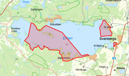
ERKEN - NOTE! New for 2026.
-A FISHING RIGHTS OWNER HAS CHOSEN TO PAUSE HIS WATERS FROM FISHING IN 2026. THE AREA AFFECTED IS THE WESTERN PART OF THE MAP KRISTINEHOLM, YXLAN, ETC. SEE UPDATED MAP.
THIS MEANS THAT THE AREA IS NO LONGER INCLUDED IN THE FISHING MAP FOR ERKEN.
-FROM JANUARY 2026, FISHING WITH LIVE-GIVING EQUIPMENT IS NO LONGER ALLOWED, ACCORDING TO THE DECISION OF THE FISHERIES ASSOCIATION.
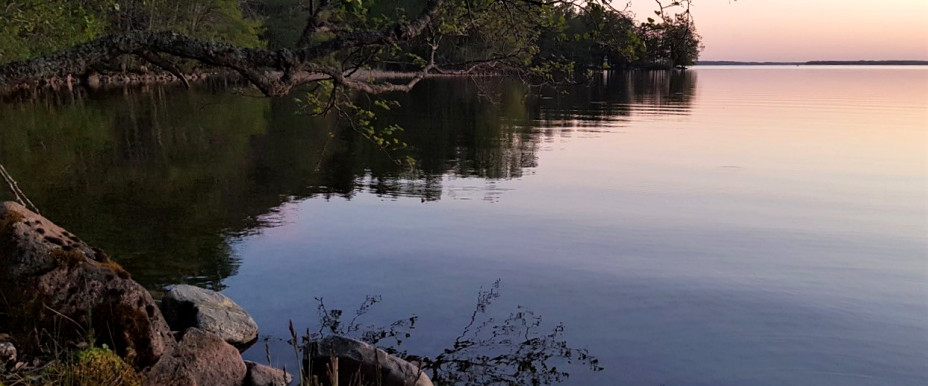
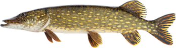
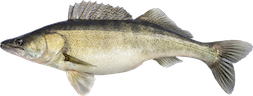
Erken is Uppland's third largest lake by volume, 23 km2 in size and with a maximum depth of about 22m, surrounded to a large extent by wilderness-like forest with a large element of blocky terrain. In the short fishing areas there are lots of interesting boulders and steeps to fish at, but also fishing at the elongated reeds can provide fantastic pike fishing!
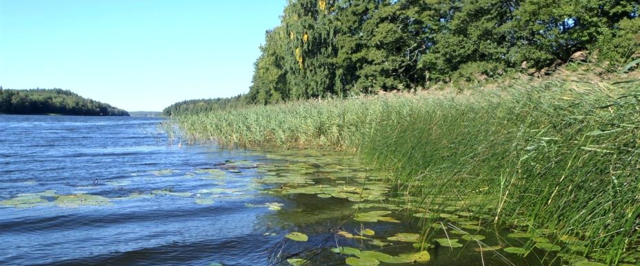
In Erken, fishing is mainly aimed at perch, pike and zander, but fishing for the most common carp, which are typical of lakes in the agricultural landscape, can also be done successfully. The possibilities for fishing from land are limited but can be done at a few places on the northern shore, from Rörvik to Hasselhorn and from the beaches inside Svanbergaviken. At "Rumpudden", between Rörvik and Hasselhorn, there are 2 wind shelters with barbecue areas.
Public and toll-free launching ramp is available at Vikingabyn ( https://kartor.eniro.se/m/QYT6O ), Svanberga! DO NOT park at the turning area, at the entrance to Vikingabyn, but parking should only be done on the driveway! Toll-free ramp means that it is open, but both Svanberga boat association and Norrtälje SF would like a fee of 100 SEK, or alternatively a season ticket of 500 SEK, to be paid as a contribution to keeping the ramp open and maintaining it (nothing that will be checked but is done by serious users)! Follow the instructions on site!
The wallet
Nutrient-rich and elongated lake with dense, elongated reeds. Shallow and rocky bottoms are completely absent, but there are parts on the southern shore that consist of rocks and rocks. The deepest part of the lake, about 7m, is in the area where the lake is narrowest.
In Lommaren, and at Lommarbadet at the eastern end of the lake, there are opportunities to launch boats in connection with the swimming pool's parking lot. Land fishing opportunities are largely non-existent, but can be carried out at some public piers in the eastern part of the lake. At the piers of the swimming pool, there are opportunities for people with disabilities to fish.
In Lommaren, fishing is mainly focused on perch, pike and zander throughout the year. Many of the lake's large perch migrate up to Lommaren from the sea after spawning via the Norrtäljeån River, then stay thanks to the good supply of food and can offer real chops in winter and summer! The most common carp fish, which are typical of lakes in the agricultural landscape, are also found in large numbers.
The gluer
Nutrient-rich and relatively shallow lake and in the area in question the shores consist of dense reeds. In the area there are a couple of shallows and also an occurrence of rocky bottoms. In the area there is a maximum depth of about 5m.
Unfortunately there are no public launch sites and land fishing is largely non-existent. Information can be obtained from Norrtälje
Angler.
In Limmaren, fishing is mainly focused on perch, pike and zander, and especially during the winter you can have success if you want, either by ice fishing or ice fishing. The most common carp, which are typical of lakes in the agricultural landscape, are also found in large numbers.
Frötuna-Kyrksjö
“Frötunasjön” differs considerably in character compared to the other waters in the short-fishing area. The lake is partly surrounded by steep mountains and slopes and partly by flatter shores adjacent to agricultural land. The depth of the lake is then and the bottom slopes very steeply in some places. The shores consist partly of stones and rock outcrops but also of both sparse and dense reeds. There is a shallow water in the area and a maximum depth of about 15m is in the middle of the lake. On the northern shore of the lake there are opportunities to launch a smaller boat. The site is reached from the old Norrtäljevägen.
Land fishing can be done from protruding headlands/rock outcrops in the southern part of the lake, towards Lönnsvik, from both the western and eastern shores. NOTE!!! Pay attention to and respect the boundaries that separate the short-fishing water from Lönnsvik's water and fishing rights holders and that it is strictly forbidden to enter private land and jetties!! There are markings on both the eastern and western sides towards Lönnsvik, consisting of white/red painted signs (white=short-fishing water, red=private water)”. In Frötunasjön, fishing is mainly aimed at perch, pike and zander throughout the year and especially ice fishing can give good results. The most common carp fish are also present.
Malstasjön
Nutrient-rich and relatively shallow lake, partly surrounded by steep mountains and slopes and partly by flatter shores adjacent to agricultural land. The shallow bays to the west and east are largely covered by water lilies from early summer. There are no public launch sites, but at the bathing area, which is accessible from the Malsta Kyrka parking lot, you can easily reach the lake with a canoe or other light craft. Talk to the municipality and show consideration for the bathing guests. Land fishing is largely non-existent but can be done at the protruding headlands in the southern part of the lake, Degaröviken.
In Malstasjön, fishing is mainly focused on perch, pike all year round, and the most common carp, which are typical of lakes in the agricultural landscape, are also found in large quantities.
Rimbo Långsjö
Nutrient-rich and elongated lake with very varied shores consisting of dense or sparse and elongated reeds, stones and rock outcrops. Several shallow and rocky areas occur.
In Rimbo Långsjö, and at the municipality's swimming area at the eastern end of the lake, there are opportunities to launch boats. Talk to the municipality and show consideration for the guests at the swimming area. Land fishing opportunities are largely non-existent from the northern shore but can be partially carried out on the southern shore.
In Rimbo Långsjö, fishing is mainly focused on perch, pike and zander throughout the year, and the most common carp, which are typical of lakes in the agricultural landscape, are also found in large quantities.
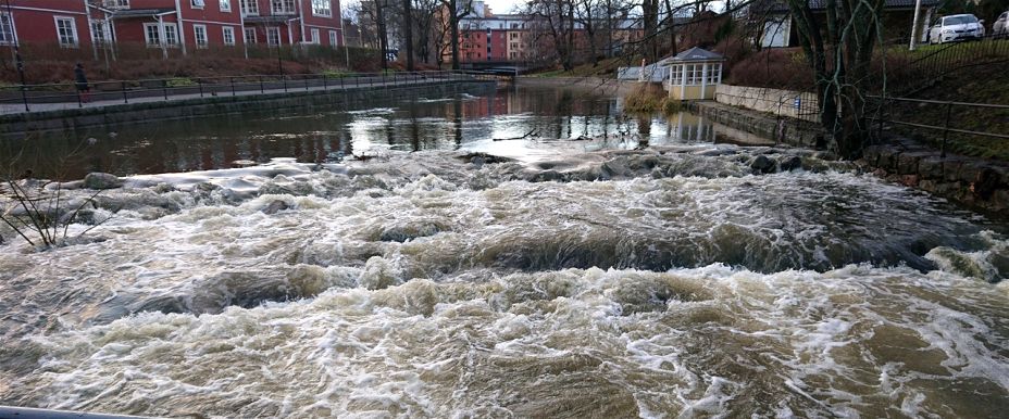
Norrtäljeån
From Lake Lommaren in the west, the Norrtälje River flows through the city center of Norrtälje until it finally flows into Norrtälje Harbor. The banks of the river are relatively accessible from the upper part down to the “Gamla Elverksbron” and consist mainly of a border of alder, ash and maple. In parts, the northern bank of the upper stretch is touched by private plots and on the southern bank of the upper stretch, private plots are touched to a lesser extent. All plot land is of course prohibited from being entered!! The course of the river is largely calm in the upper stretch.
The middle part of the river from just upstream of the "Old Power Plant Bridge" and down to the white bridge is also called the Society Bridge, the "Fly Fishing Bridge", the river drops out about 3m which naturally creates a course from weak to strong flowing sections during average water flow. After longer periods of rain the flow can become very high which makes some parts of the middle section unsuitable for wading. The banks along the middle part mainly consist of hard surfaces which make accessibility minimal which requires wading. Wading is only done from one side!! Follow the instructions!!
The lower part of the river extends from the bridge at Åtellet and out to the diving bays in the entrance to Norrtälje Harbour, which are level with the sea pier. The beaches along the lower part consist mainly of hard surfaces. Accessibility is very good!
Valid only in certain waters or in certain places, see fishing rules / comment
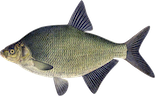
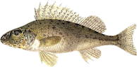
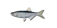
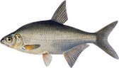
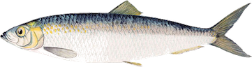
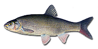
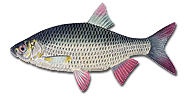
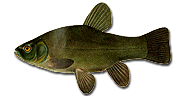
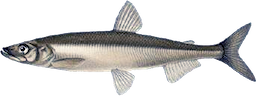
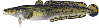
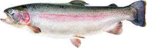
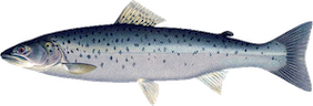
Fish species


Sportfiskarna Norrtälje
Ever since 1919, anglers have worked to ensure that there is good fishing in clean waters with healthy fish stocks. Our goal is to develop long-term sustainable sport fishing that is accessible to everyone.
If you have questions about specific fishing cards, which rules apply, when the cards go on sale, etc., please contact the respective fishing area. iFiske.se has no local knowledge of rules and fishing conditions etc. beyond what is available on the website.
Organization number: 802004-4288
Customer number: 3065, Area: 3070.Contact persons
Sportfiskarna Region Mitt
08 - 41 08 06 80
Files to download
Fishing areas nearby Sportfiskarna Norrtälje
Affiliated fishing areas in Stockholms län